TABLE OF CONTENTS
Ecosystem Extent
Ocean Accounts Case Study: Algoa Bay
Algoa Bay is situated in Gqebehra, South Africa and is a representative area to test applicability of this framework and associated online tools because of its complex web of marine users, productive upwelling environment, dynamic oceanographic forcings in the bay, long term data availability, ongoing multi-organisation collaborations , and topical work underway through the work of The Algoa Bay Project and the Marine Spatial Planning (MSP) strategy (under the jurisdiction of the new Marine Spatial Planning Act (Government of South Africa, 2019)).
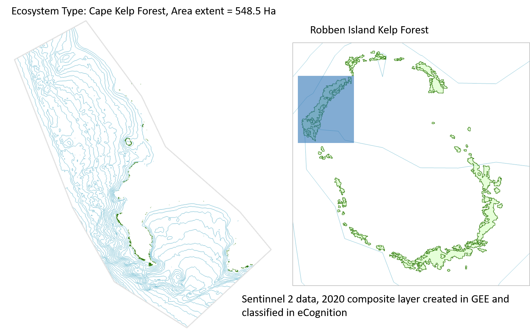
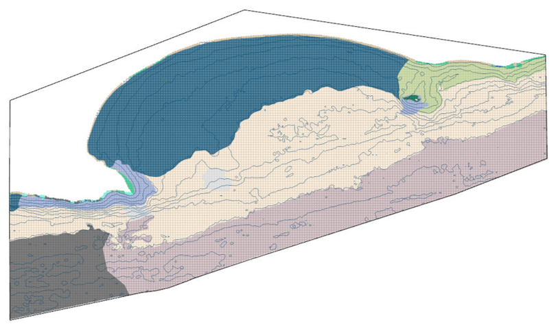
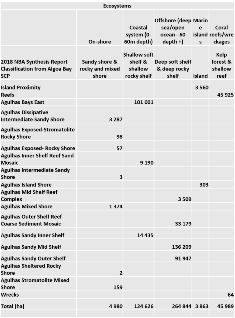
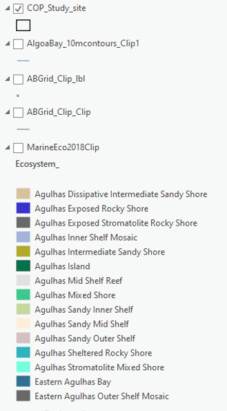
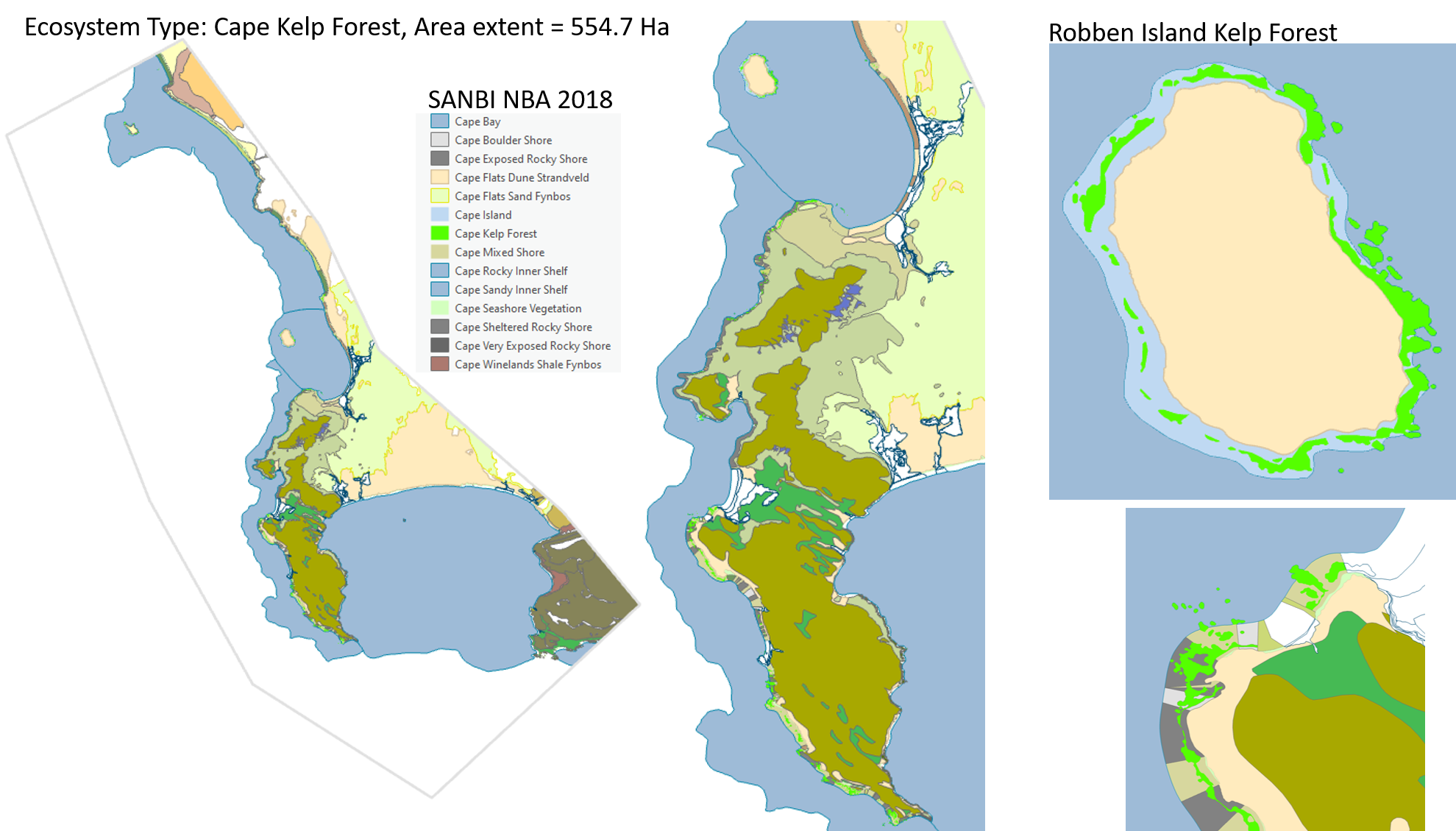
The starting point for any Ocean Accounts application is capturing metrics on ecosystem area extent which can be done at a global, regional, national or local scale. Depicted below is a local scale example of marine ecosystem type extent based on SANBIs 2018 National Biodiversity Assessment 2018 where area of ecosystem type by hectare is measured within a GIS application.
Explore Data
Algoa Bay Project marine spatial layers including bay scale ecosystems, user groups and habitat types, plus more can be viewed and interacted with below. Certain layers were originally compiled by and can be downloaded at The Algoa Bay Project site and contain ABP in their title, additional spatial data providers include SANBI, SAIAB, SAEON and NMU CMR and CGS .
Areas of Interest
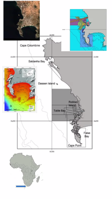
Table Bay and False Bay are additional case study areas being explored in South Africa where valuable ecosystem types like kelp forests can be mapped, measured and quantified for contribution to biodiversity, environmental health, carbon sequestration and economic productivity.
Ecosystem Type Example
Data Scalability
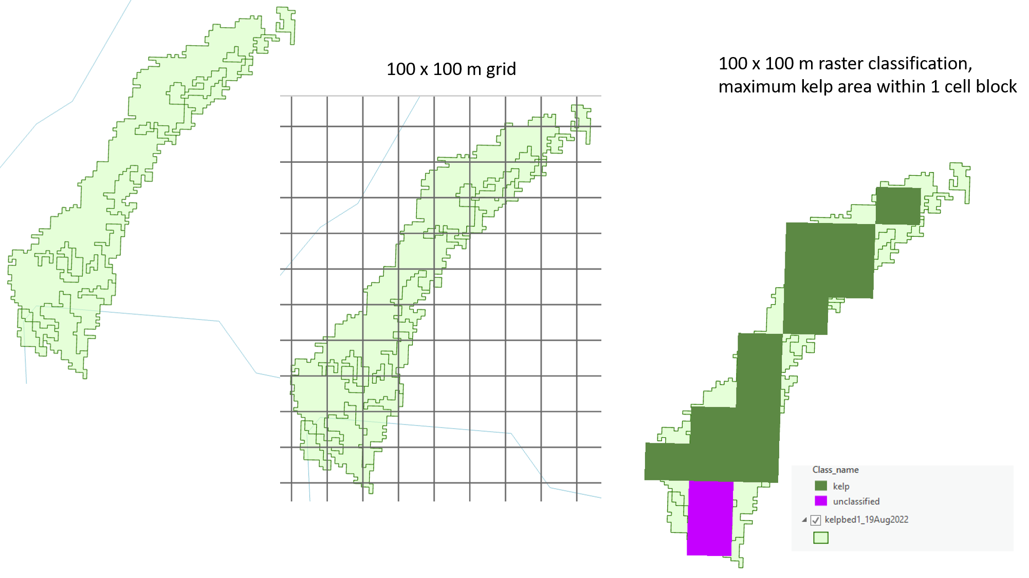
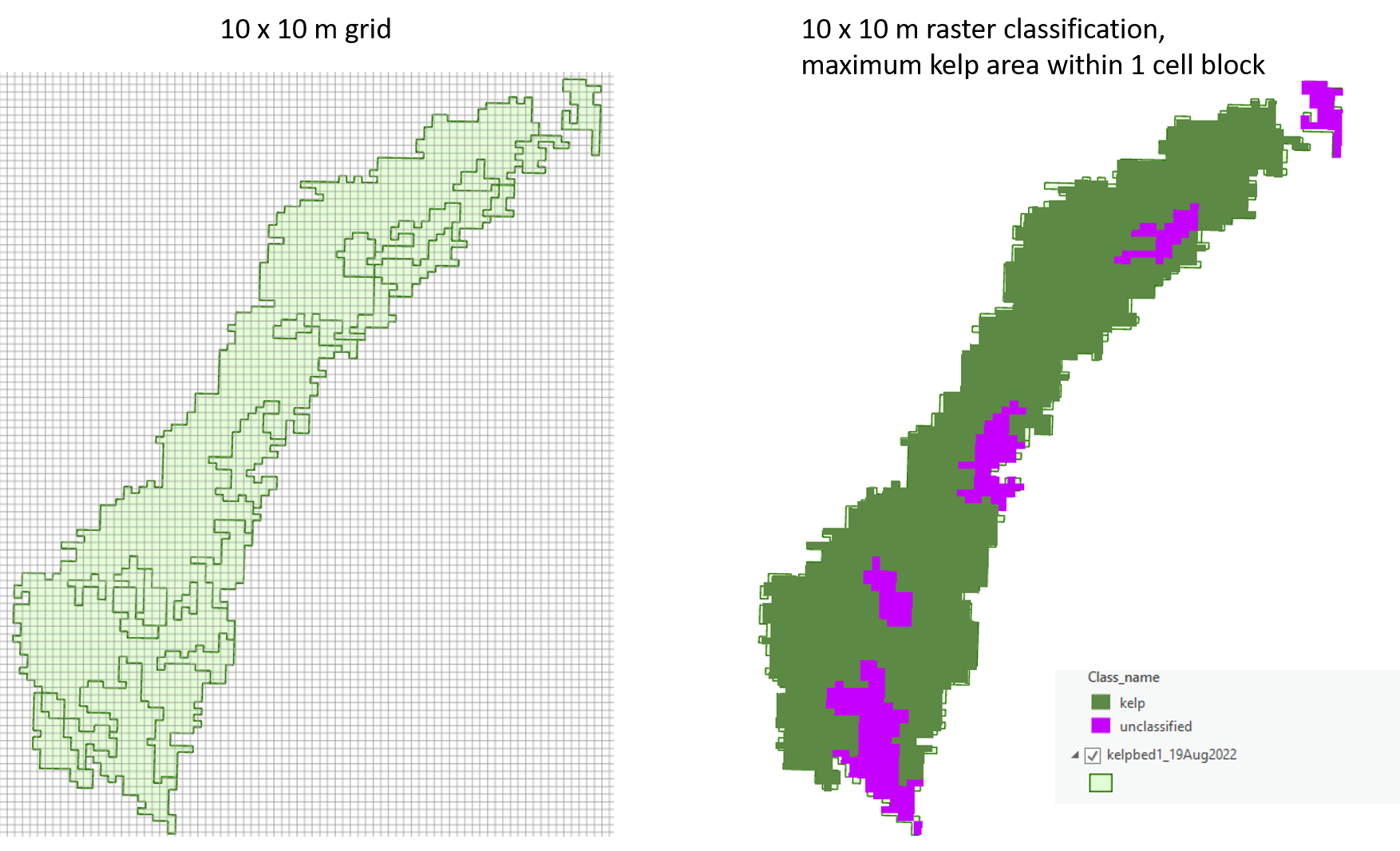
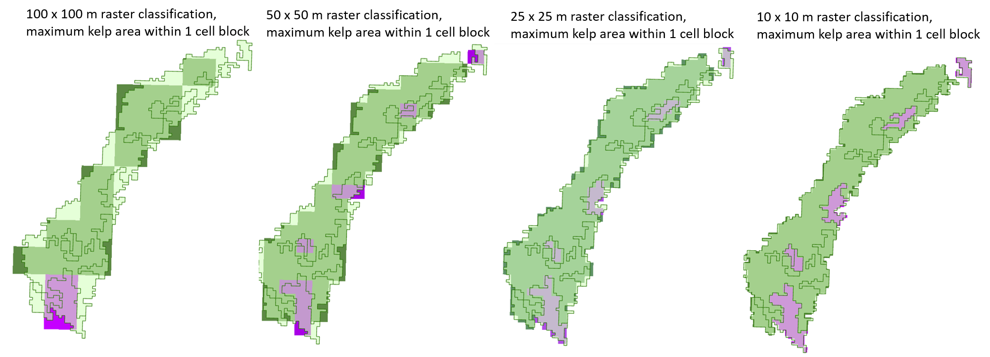
Data driven scalability is an important aspect to consider when determining the size grid to use in mapping area extent. Here Sentinnel 2 data products were used to get a ‘best fit’ kelp forest area in the Cape Peninsula region.
To learn more about modelled data applications in Ocean Accounts click here.
